It’s the Treble for the Double Trouble 2 day Challenge
Back for the 3rd year!
10:00am Saturday 16th & Sunday 17th March 2013
10th November 2012 update:
Both days are now sold out.
Information about the Race
This challenge is the Gin Pit Marathon 26.2 mile course of one large loop to be completed twice over 2 days.
My inspiration for this marathon started back in 2010 when I realised I was always having to travel to run a marathon. It occurred to me that there are very few local marathon events.
With the help of friends and my running club Astley & Tyldesley Road Runners we have created a low key event with a friendly, homely and welcoming feel that gives local runners the opportunity to run a marathon or even a double marathon on their own doorstep. As far as I know it is the first of its kind in the area. Runners from further a field will still be more than welcome to sample our hospitality but it will be their turn to travel! I think the event offers something a bit different that will leave competitors with fond memories for a long time and maybe I’ve started something that will continue for many years to come. I’m so pleased with the positive comments from entrants over the past 2 years and with interest in the event growing, I hope the event will be enjoyed as much by runners in 2013.

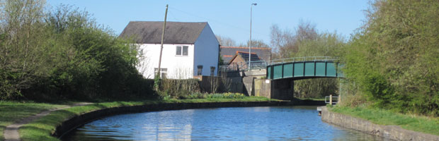
The course is one large loop taking in 11 miles of canal tow path, 9 miles of trails, which are mostly derived from disused railway lines but I’m afraid there will be 6 miles on public roads. Sorry I couldn’t find a way of making a whole course road free.
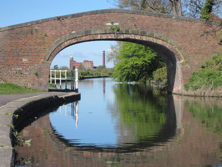
I must thank our northern industrial heritage for giving us these lovely trails and canals to run along. It is fascinating to imagine that many years ago these trails would have seen large steam trains belching out huge amounts of stream and pulling heavy loads of coal. The canal tow path would have had horses pulling fully laden barges along the Leeds Liverpool canal, locally known as the Bridgewater canal. Today they have been transformed into tranquil trails and paths which we can enjoy, away from the bustle and fumes generated by 21st century traffic.
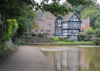
Look out for the picturesque village of Worsley at 9 miles, with its beautiful black & white mock Tudor buildings contrasting with the unusual orange canal water. At 11 miles you will pass through the village of Astley where the coal mine’s pit head still remains. Its iron work & wheel stand proud above everything else as a lasting reminder of the industry that used to overwhelm the whole area.
The beauty that has come out from the coal dust of the industrial revolution can be enjoyed by those of us willing to leave the roads behind to explore and probably get muddy!
During periods of wet weather the course can be very muddy in places and trail shoes are recommended for these conditions.
The Start and the finish are at the Miners Welfare Club, Gin Pit Village, Ley Road, Tyldesley, Manchester, M29 7DW (pictured below).
Please do not enter the Welfare Club in muddy trainers and running gear, you will get me into TROUBLE!

Race limit is 45 runners per day.
There is a 6 hour time limit each day.
Minimum age 18 and all competitors must have completed a sub 6 hour marathon within 12 months of the race day.
The event is held under UK Athletics rules.
Trail Running Association Race Permit Number: TRA/05-13.

Race start time 10:00am each day.
Daily pre-race registration and collection of race numbers will be 9am at the Walfare Club next to the start.
Maps and directions will be available at registration each day.
Competitors are able to enter either day of the event or both, just indicate your requirement in the appropriate boxes provided on the entry form.
Any updates will be posted on this webpage.
Click here to download entry form
Click here to enter online (online entries have now closed)
Click here to see March 2013 confirmed entry list
Click here to follow a link to a map of the course
Click here to download a map of the course
Click here to download course directions
I have created the directions as a word document so that competitors may alter it to fit their individual needs, for example increase font size to make it easier to read while running.
Click here to download a list of local places to stay

The event is a self guiding course, maps and directions will be issued at the start. There will be water stations at 4 points along the course at 7.85 miles, 13.2 miles, 19.3 miles & 22.25 miles. Taking a hydration pack or a bottle of water and energy gels is encouraged. I hope to make the stations manned check points but this depends on the level of volunteers I can muster.
Results will be posted on this website the day after the event.
Click here for March 2013 results
For runners looking for medial advise please follow the link to the Runners Medical Resource Website.
For runners’ safety information about the course and race day, click here.
For a copy of the event’s risk assessment, click here.
Recommended kit
Equipment:
Directions (available at the start of the event)
Garmin (will work well in conjunction with the directions)
Mobile Phone (fully charged & switched on)
Waterproof map cover
Map
Compass
Whistle
Clothing:
Hat and gloves
Waterproof top
Long sleeve top & leggings
Trail shoes
Money raised from this event will be donated to the Brathay Trust to help their work supporting disadvantaged young people and helping them fulfil their potential. Brathay deliver community programmes through schools and councils, backed up with residentials at their hall in Ambleside. They also run the Lowbank Ground centre in Coniston for Wigan Council, supporting and helping develop thousands of children and young people in the North West every year.
I wish you all the very best and hope you enjoy the event.
Malc Collins
Race Director